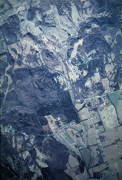
LEAPS
now offers aerial photography services. We can provide single photo
coverage for up to 4,000 acre plots. Larger areas can be covered using
digital mosaics. The photograph shown is south of
Bethesda, Tennessee and covers an area of 3 miles by 2 miles and was taken from
an altitude of 10,500'. We utilize a vertical camera port in the plane so we get an
accurate depiction of the landscape suitable for use with superimposed GPS grids and other
tools of analysis. We offer the following formats:Slides
Prints - 8"x 10" and 5"x 7"
100mb Digital files in TIFF format
Smaller JPEG format files for use in
PowerPoint, Word, Excel or other Microsoft applications.
We can supply the prints or files
finished with property lines, titles or other baseline information to your specification,
ready to use.